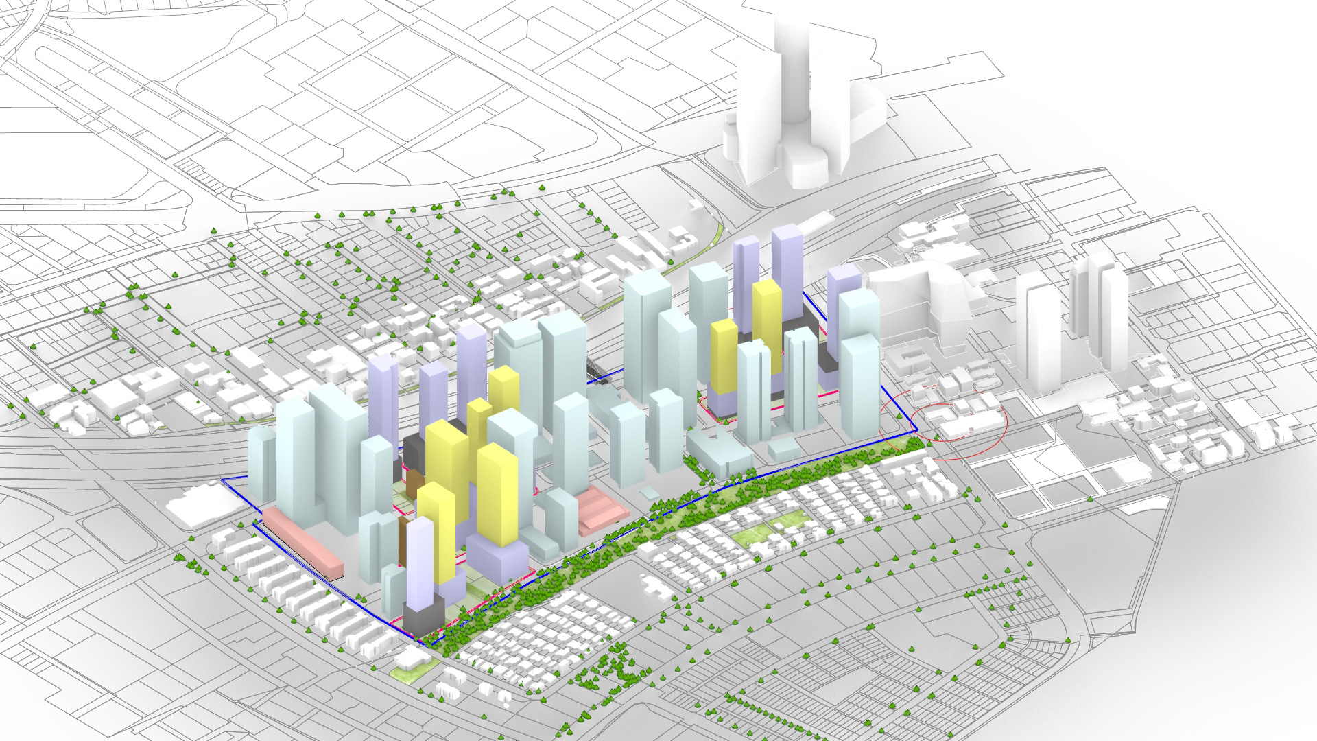
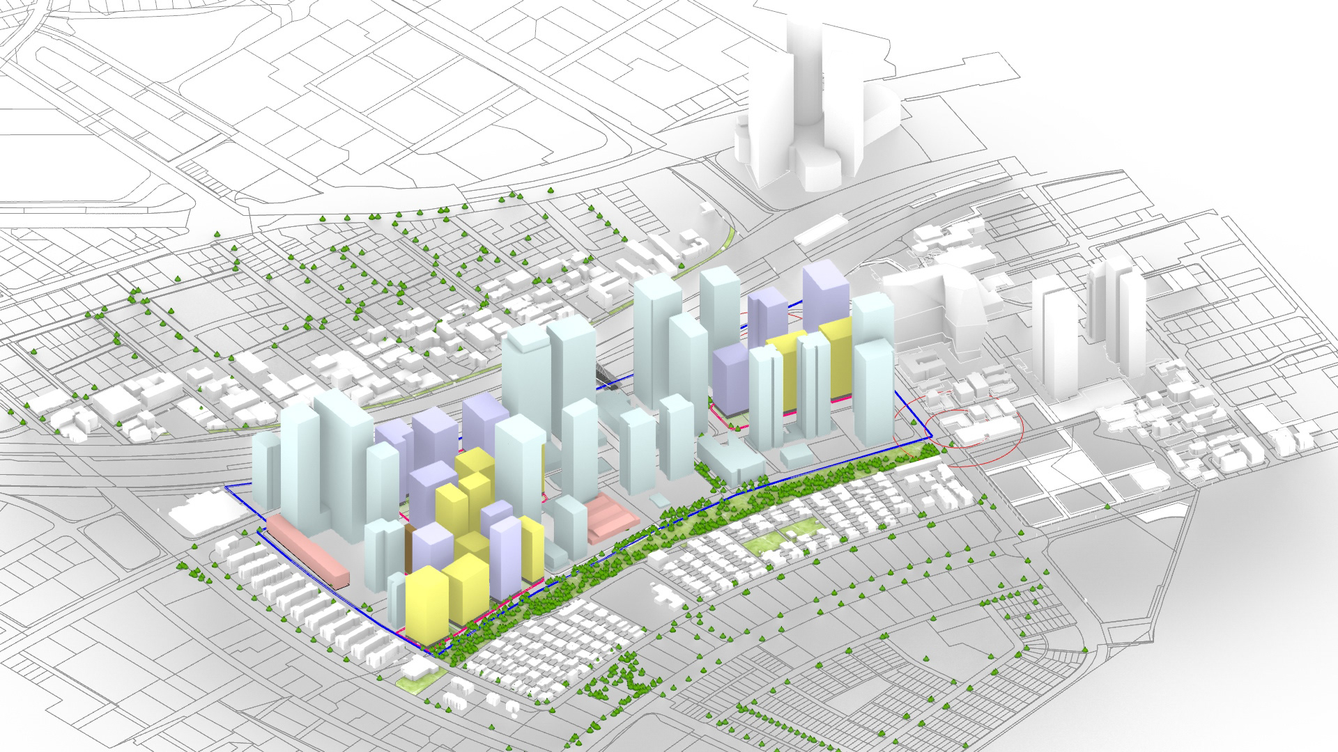
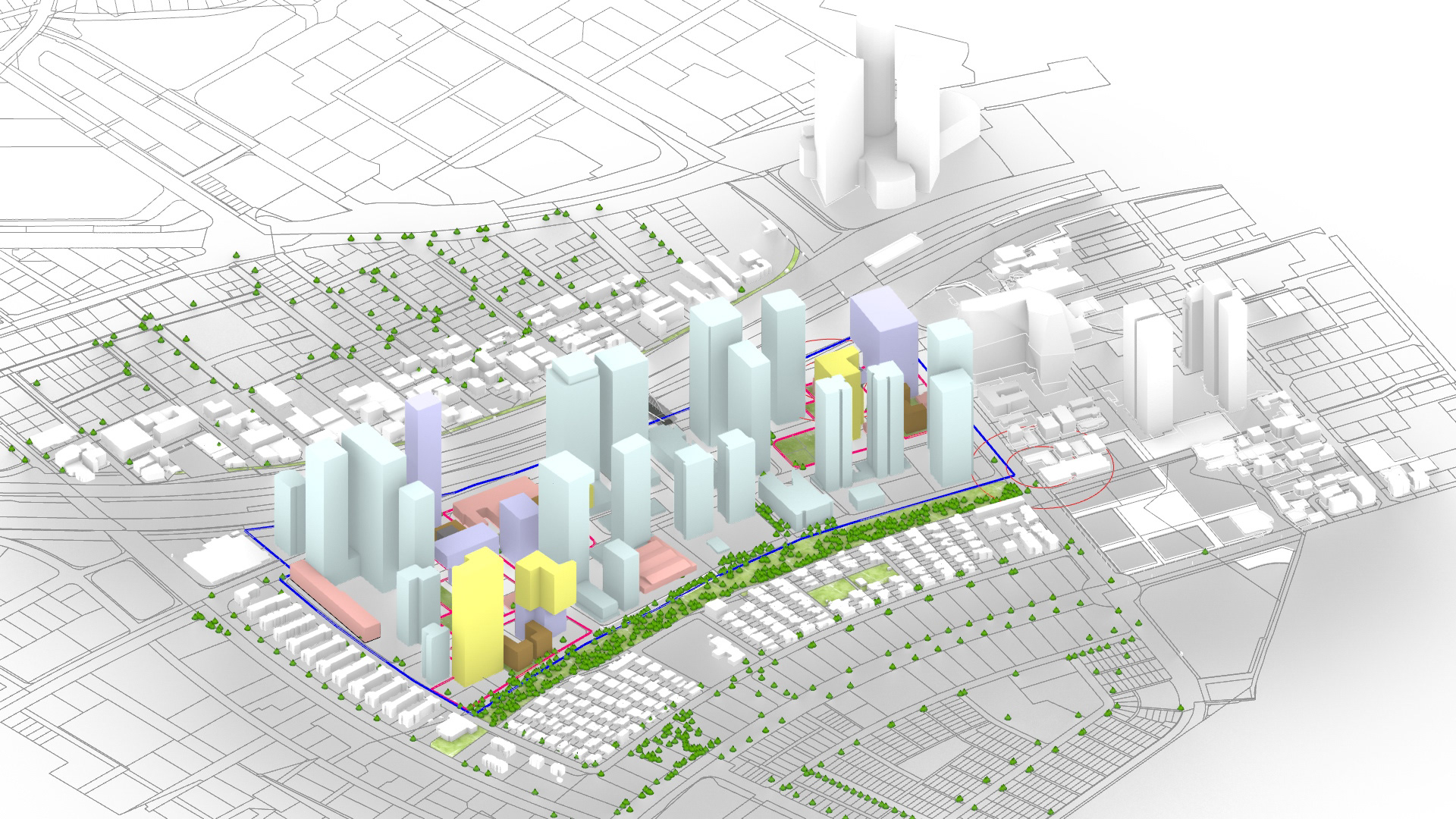
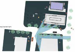
Left: Current and approved state, collaboration: My role: data analysis, 3D model generation. Graphic post production: Yael Zikiyahu
MY ROLE:
Head designer, project manager, algorithms, digital analysis, generation and optimization models, graphic material production
TEAM:
Yehoshua Gutman, Adi Assif – Managing partners
Yael Zidkiyahu – Architect
Israh Hijazi – Referent at Tel Aviv Municipality
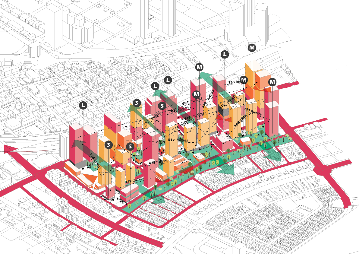
Bizeron, Tel Aviv | Optimisation for a changing world | 2020 - ongoing
“Given that the world’s cities will double in size by 2050*, design is increasingly urban design. And given that as much data is now produced almost every day as throughout human history up to 2007**, architecture is increasingly information architecture.
Our project attempts to challenge and reimagine the complex and multilayered nature of our built environment in our time of social, economic, climate and technological change.
*United Nations, Department of Economic and Social Affairs, Population Division, World Urbanization Prospects: The 2014 Revision, Highlights (ST/ESA/SER.A/352) New York, United Nations, 2014).
**Martin Hilbert and Priscila Lopez, “How to Measure the World’s Technological Capacity to Communicate, Store, and Compute Information”, International Journal of Communication 6, 2012, 956-979.
GIS DATA OPERATED:
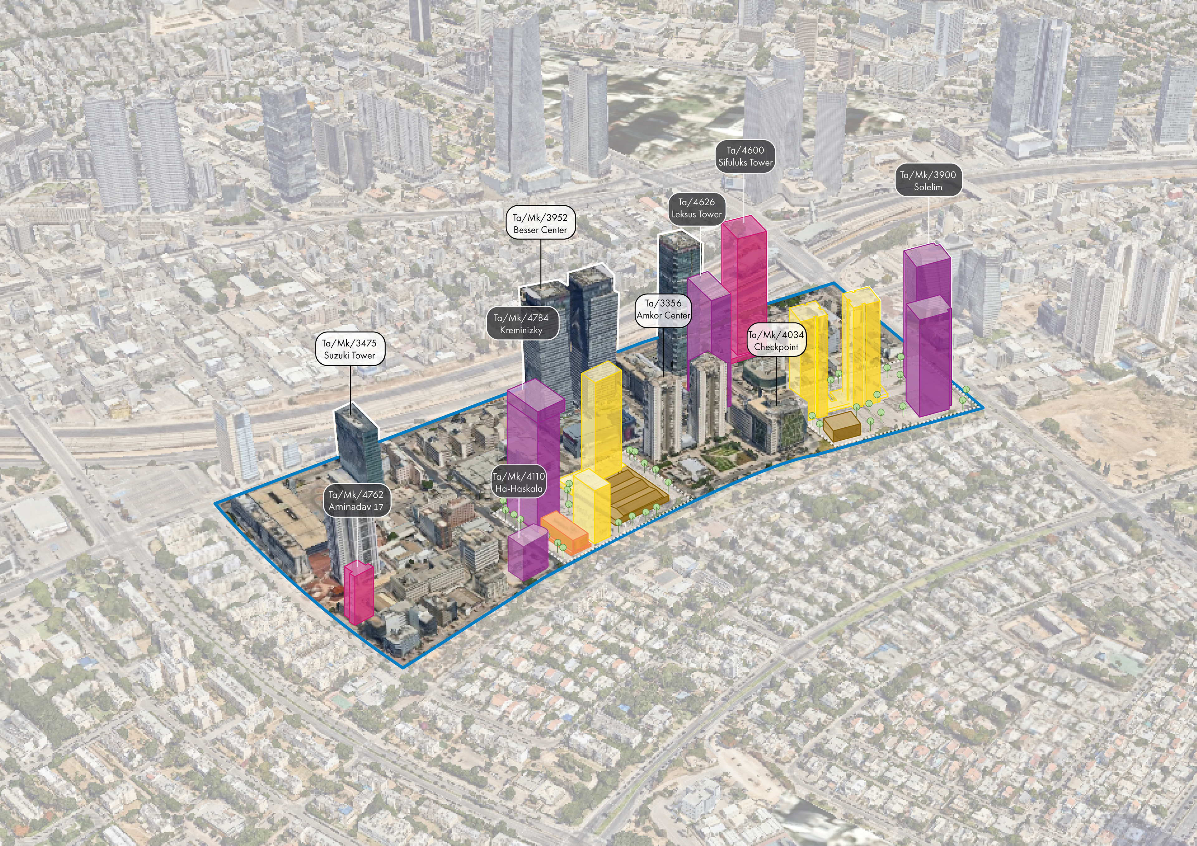
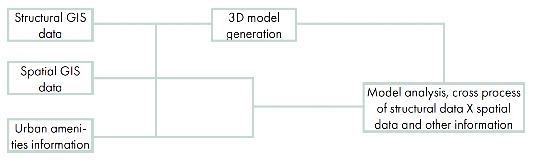
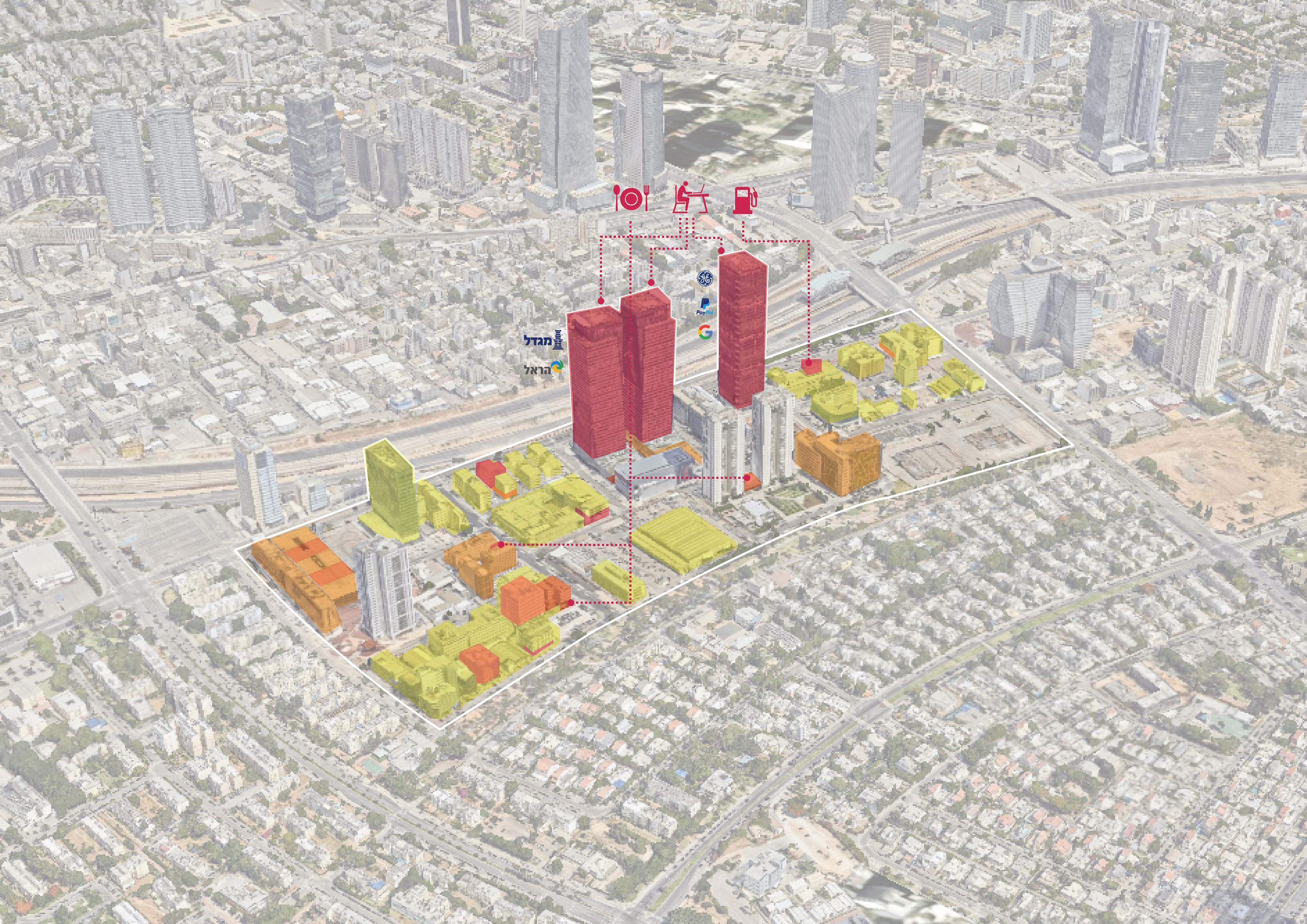
By relying on GIS (Geographic Information System) and data, we used parametric design tools to analyze the “human experience” of the individual in the urban built environment. The main objective of the project is to examine existing intensive urban conditions, simulating through them and analyzing future potentials, protecting the continuation of the human scale experience.
We created site-specific analyses to allow an unmediated understanding of the site from the point of view of the city dweller. These tools also allow us to comprehend the changes and alterations that the site has endured throughout the years; to simulate possible future scenarios, understanding the impact of those changes on individuals within the urban fabric.
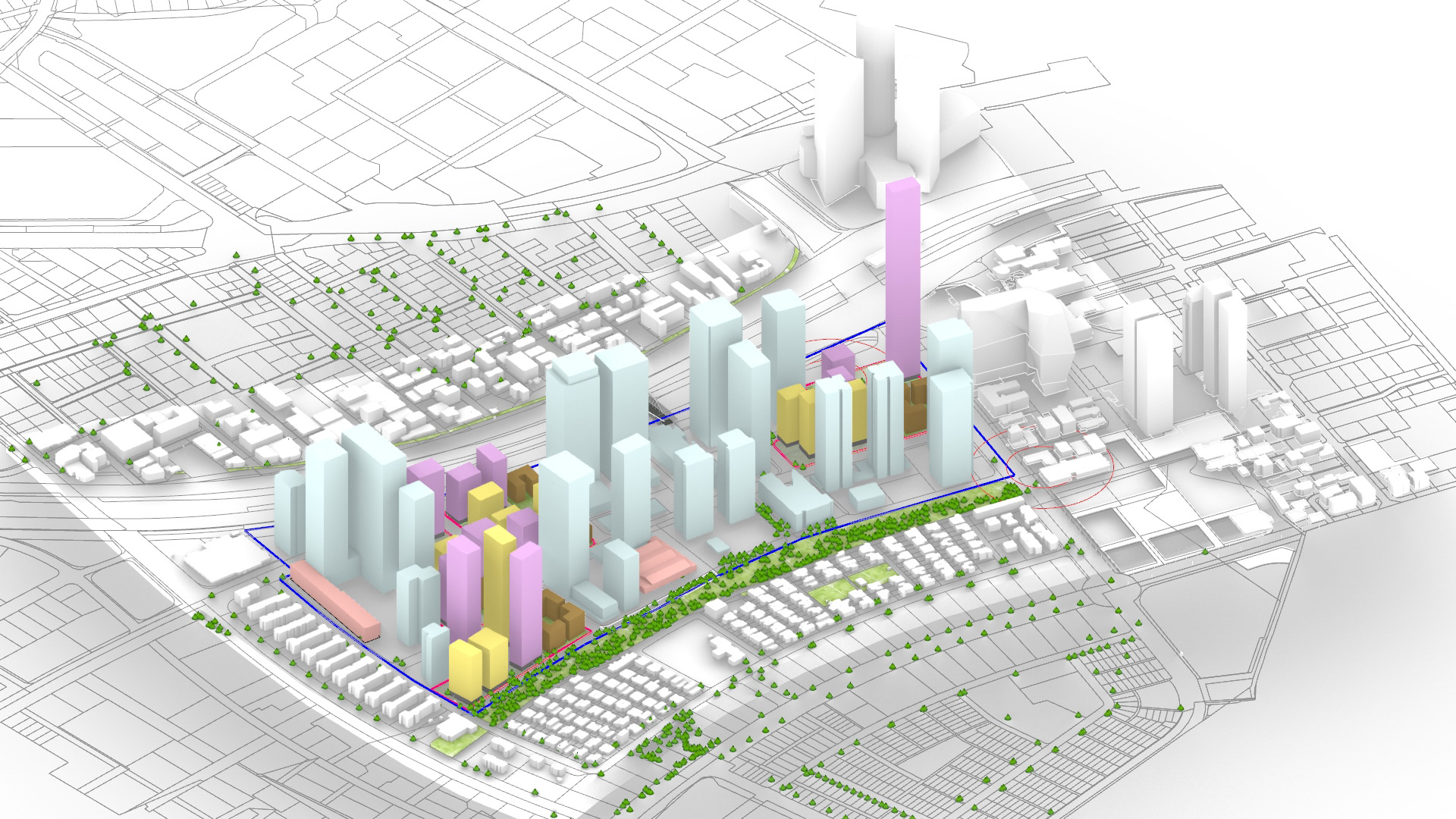
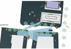
Top: Human activity heat map, 11 a.m. My role: data analysis, 3D model generation, graphic post production
We developed analytic and synthetic tools that allow us to optimize the design process. Also for its users to understand the impact of architectural acts – on the city, on society, climate change, cities’ fast growth ,and future crises (pandemics etc.). This process generates optimized solutions that would transform the way our cities are to be planned and built. We plan for a future of smart, data-driven design that can respond to the complexities of daily life. We see responsive, soft and adaptive urban planning allowing: cognitive building typologies, incorporating old and new, small and large, planning for a difference of users and land use in intensive environments for present and future users. We see adaptable and flexible solutions fit to respond to whatever the future will hold.
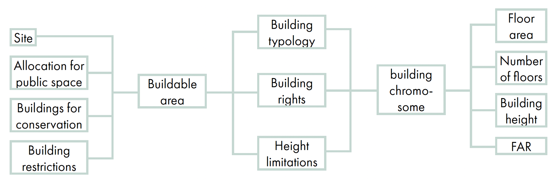
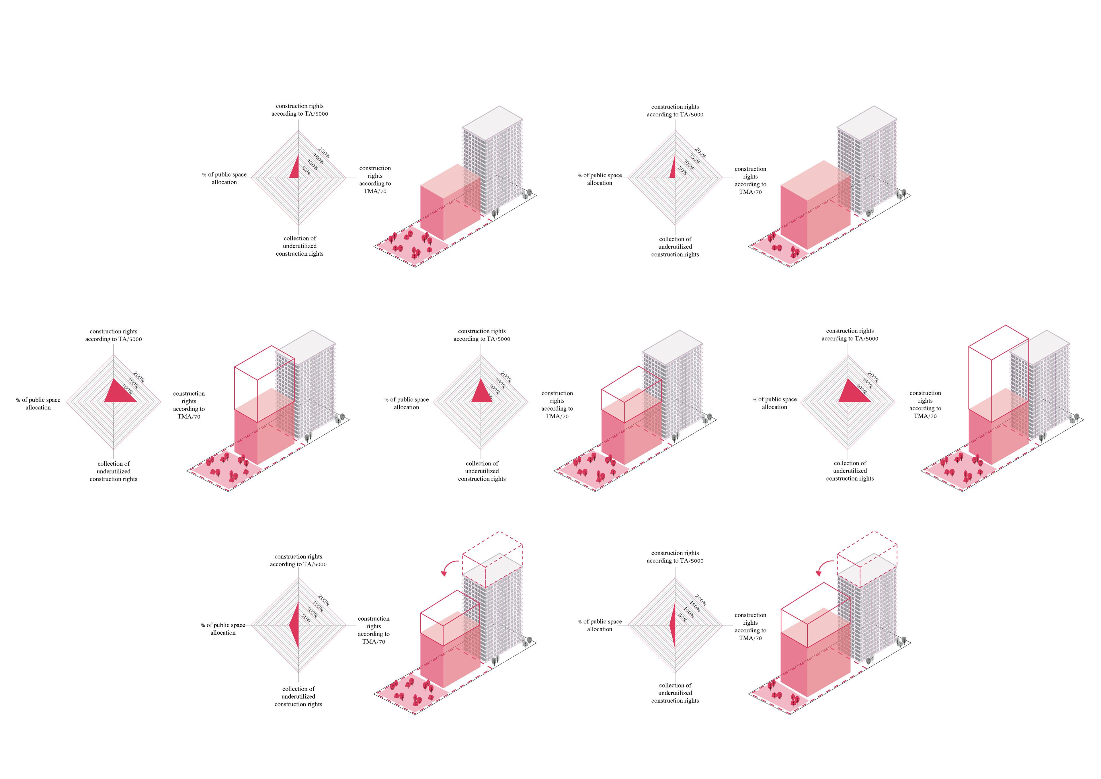
Algorithm visualization for the generation of building alternatives. My role: algorithm, spatial planning, graphic visualization.
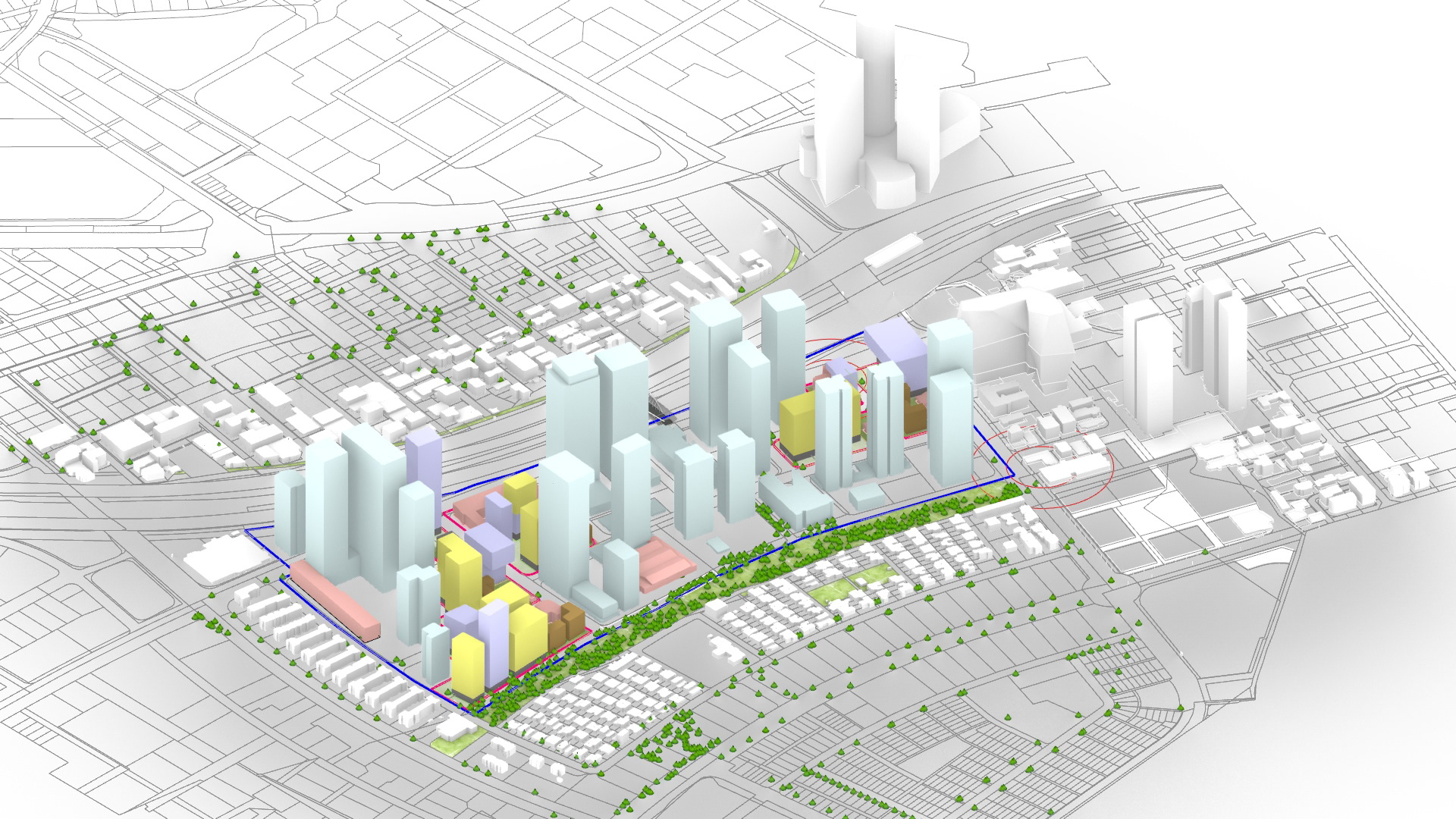
Vision Diagram. My role: development, graphic production.
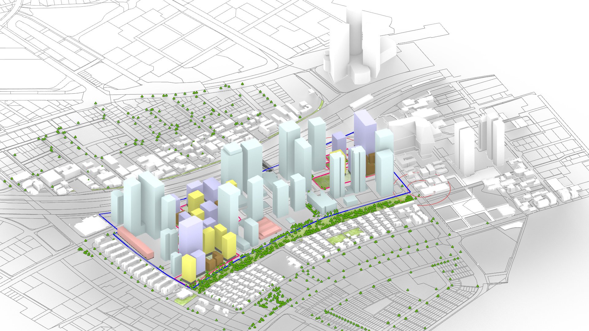
Building variations generated from various input data. Rhino + Grasshopper
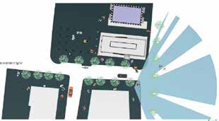
Optimization algorithm: spatial analysis from the point of view of the pedestrian.


