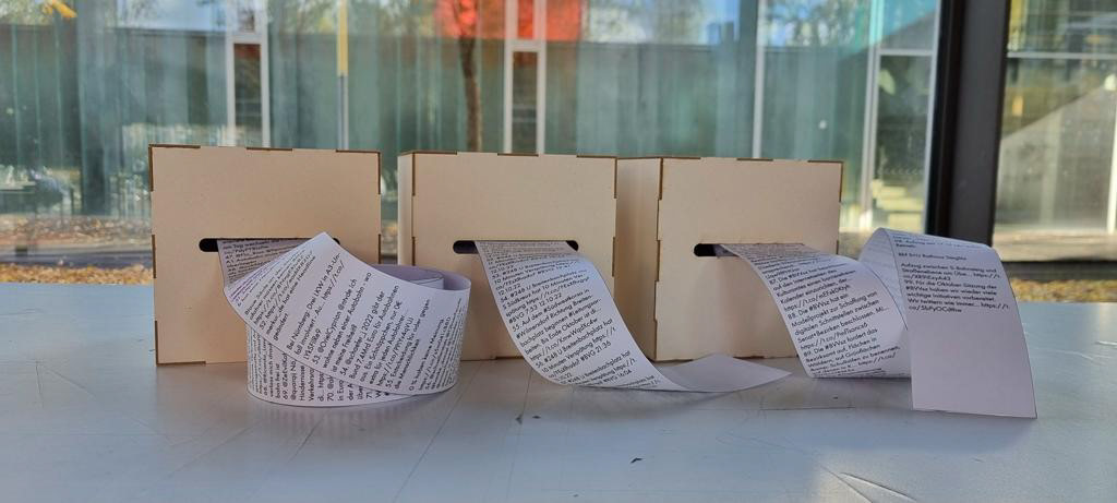
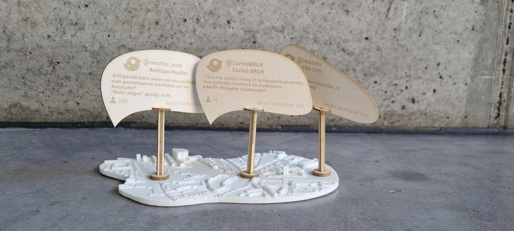
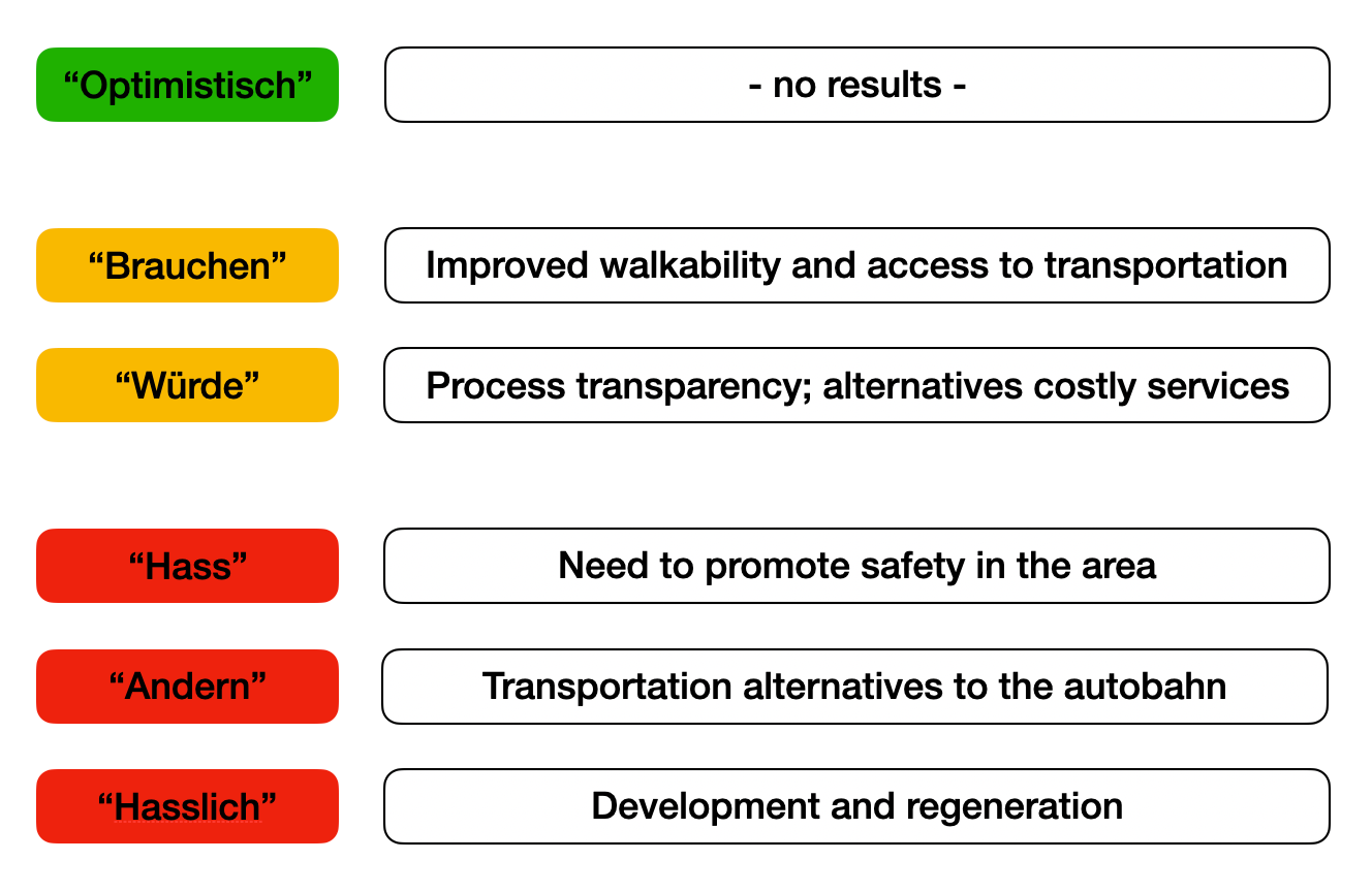
Situated in Stieglitz in Berlin and dealing with the demolition of the A104 highway, my recent research project challenges superstructures and architectural whim and aims to introduce indirect citizen participation into acts of urban regeneration. The project utilizes social media data and analyzes Twitter posts, in this particular example, which were geo tagged in the research area and deal with topics related to the urban tissue (i.e. highway, urban squares, Stiglitz itself, etc). Three tweets from different categories were then selected and highlighted, in order to raise awareness of key issues in the area.
Reaching a critical mass of social media users in the area, the project deals with digital modes of citizen participation. The project aims to propose urban solutions that correspond to the public discourse in the study area.
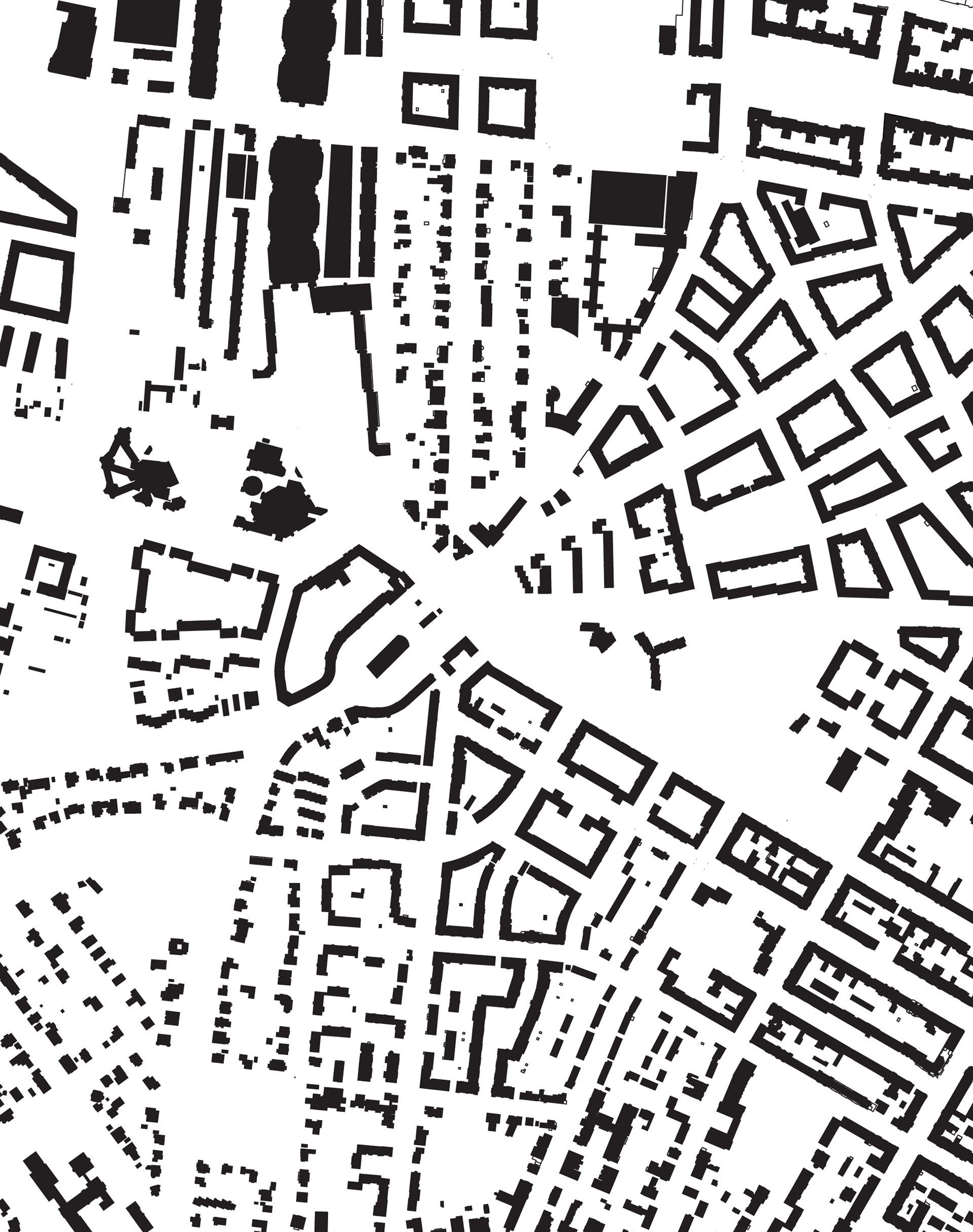
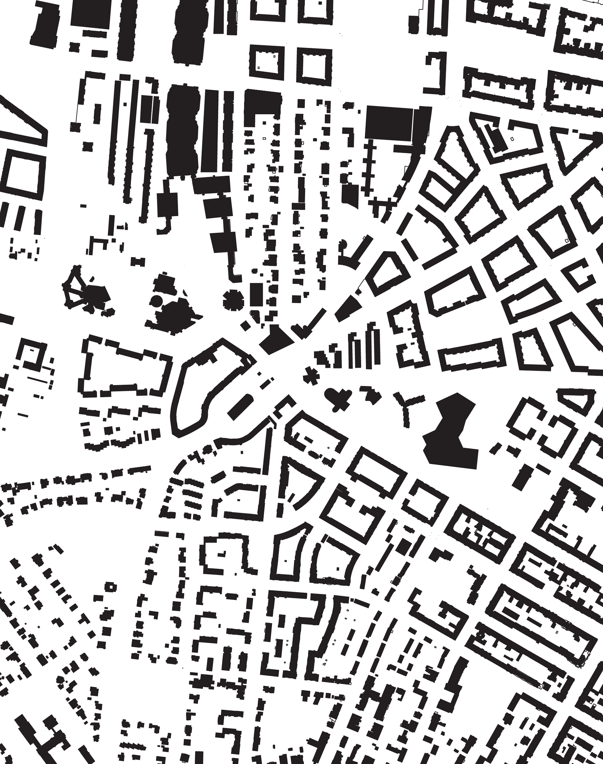
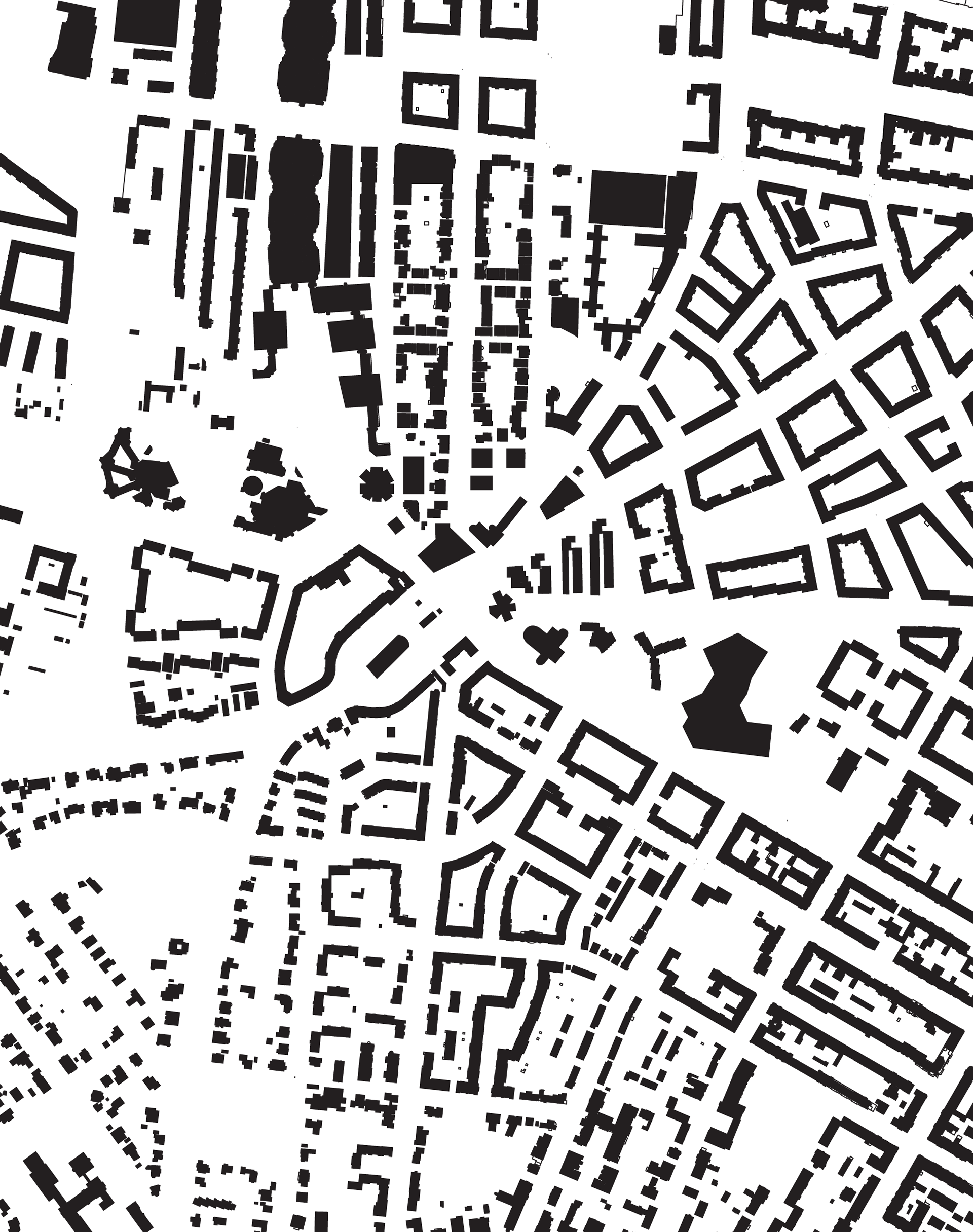
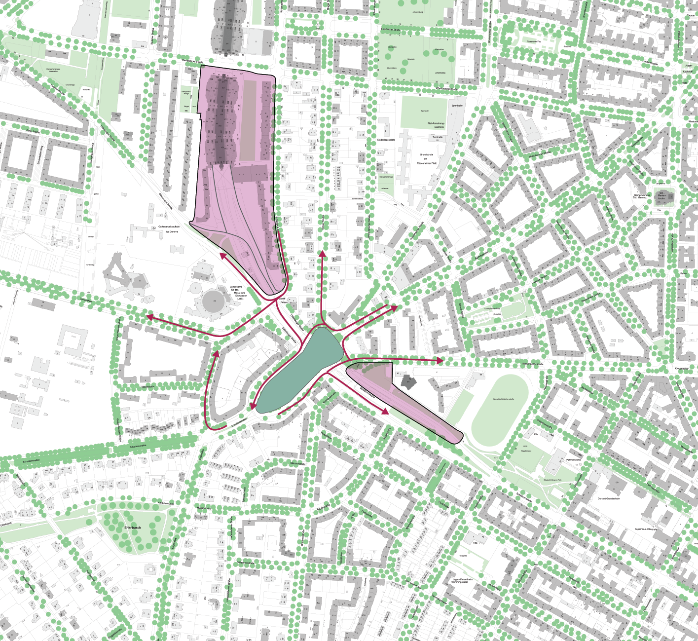
The project is located around the A104 highway bridge in Berlin. The A104 is a motorway in Berlin, Germany. It is also known as the Stadtring (City Ring) and connects several major highways in and around Berlin. It was built in the 1970s and is currently being demolished and rebuilt.
99 Twitter posts were posted on Saturday morning alone, geo tagged in the research location, expressing public opinions about the neighbourhood they call home . When dealing with the autobahn, one comment that stood out is "every highway dreams of becoming a bicycle lane when it grows up". Public transportation delays highlight the need to address urban mobility.
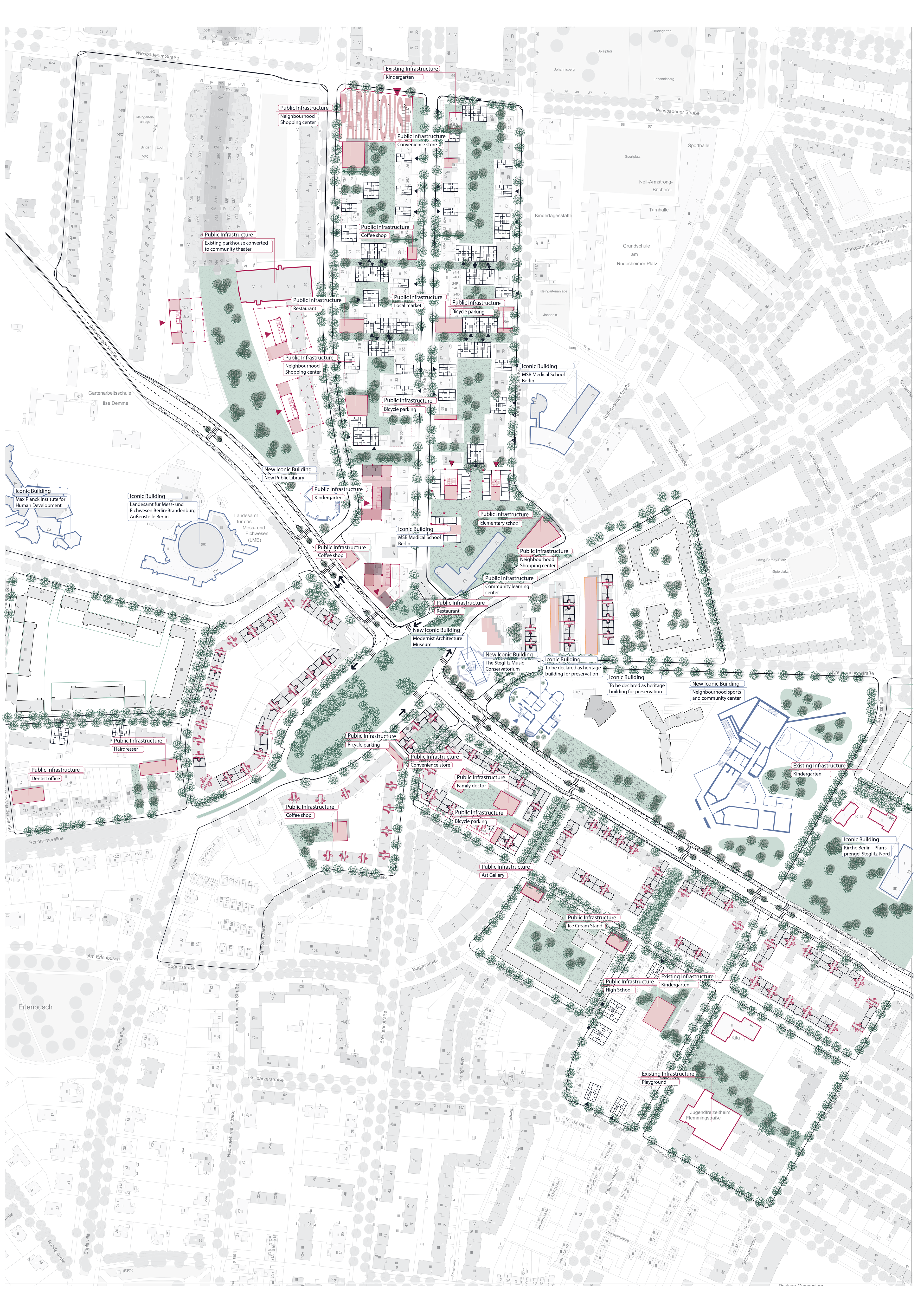
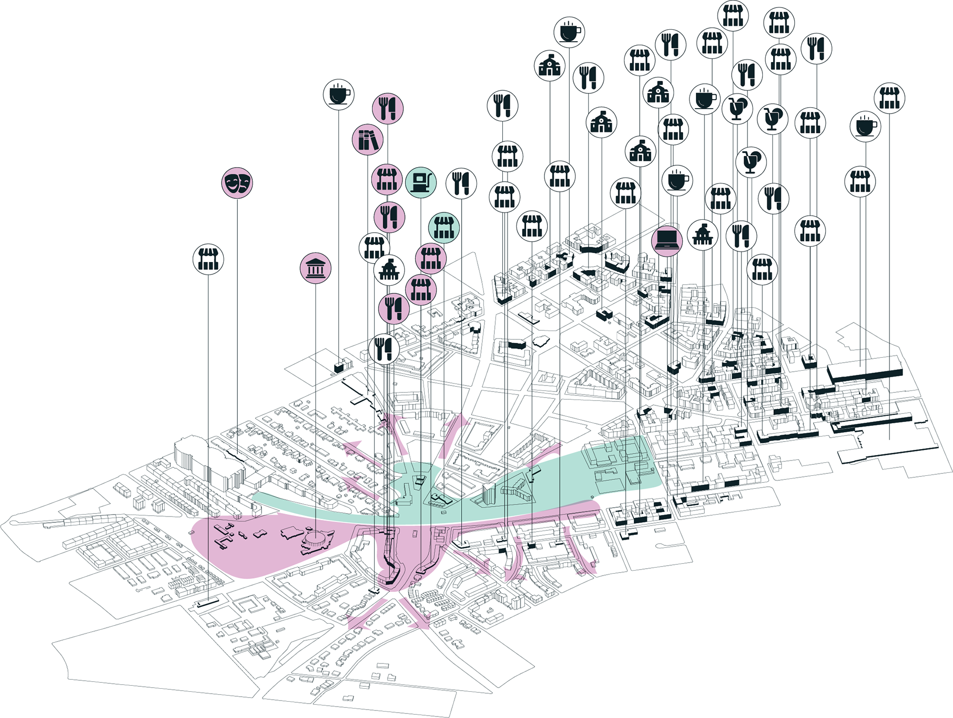
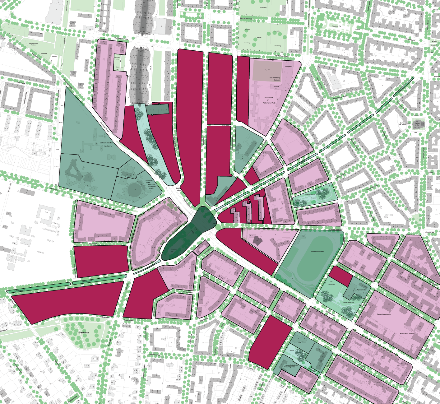
After surveying GIS layers geo-tagged to the area, I have identified a functional lack of public and commercial functions and infrastructures in the area of intervention as a driving force for emphasis (pink) or redesign of the urban tissue.
Step 1: Demolition of the highway
Motor mobility change
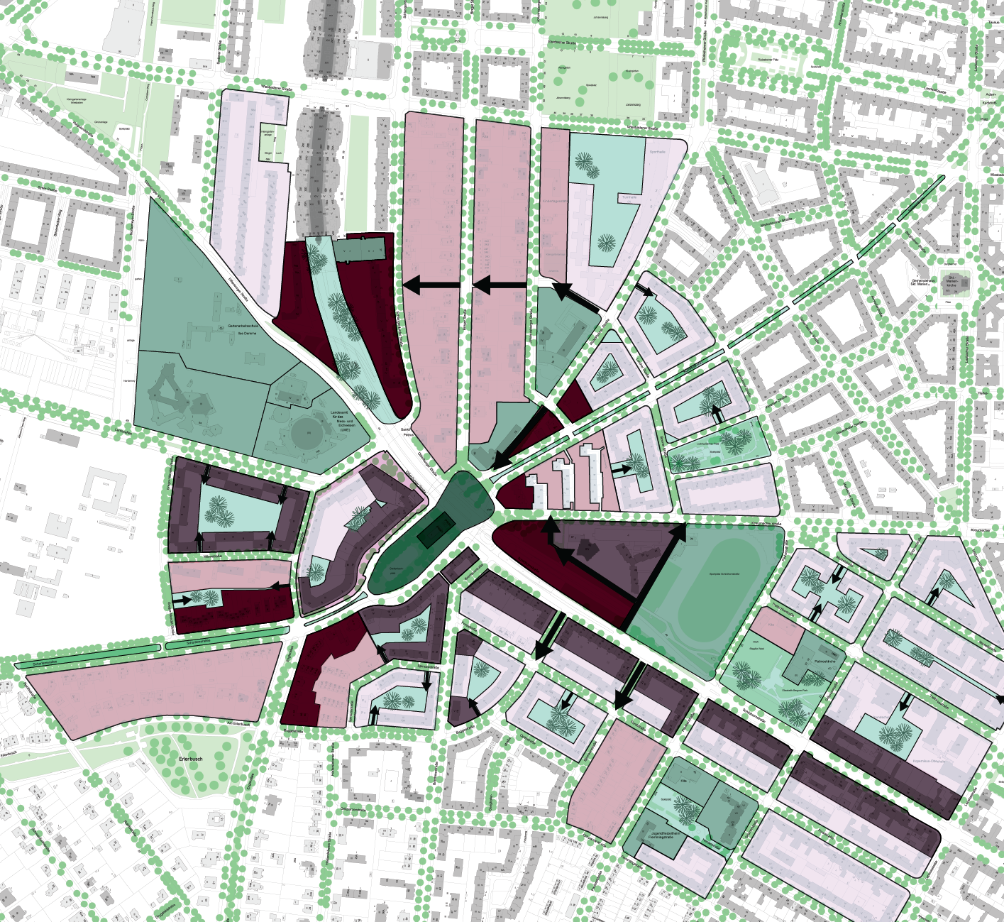
The first step in this project is the demolition of the highway. This will lead to a change in motor mobility in the area. As a result of the highway being demolished, the square will be enlarged to create more pedestrian space. Additionally, the plots of land next to the highway will be enlarged at the expense of existing car lanes. The rearrangement of motor mobility around the square is necessary to accommodate these changes.
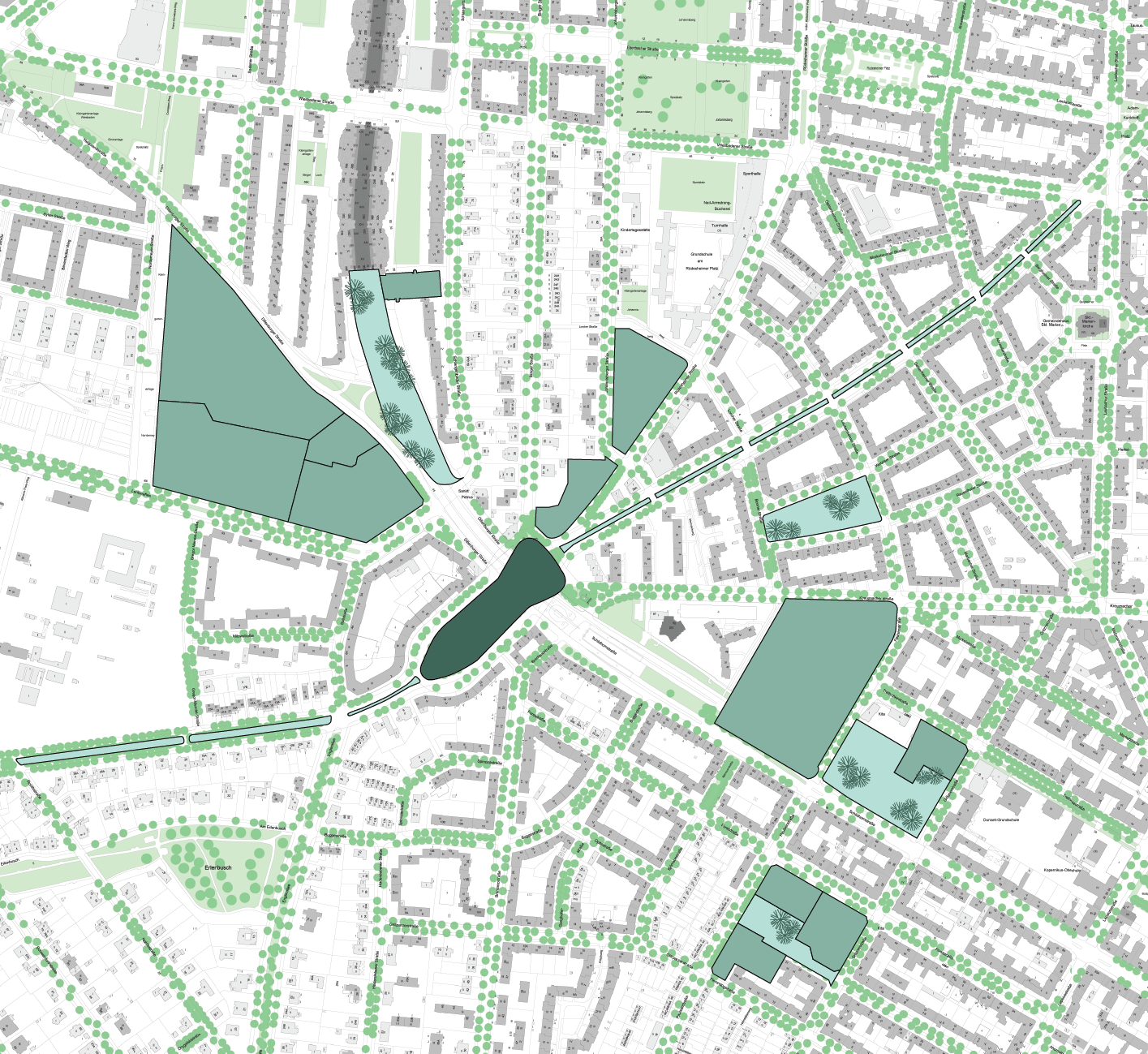
Step 2: Public Infrastructure
Definition and designation of public spaces
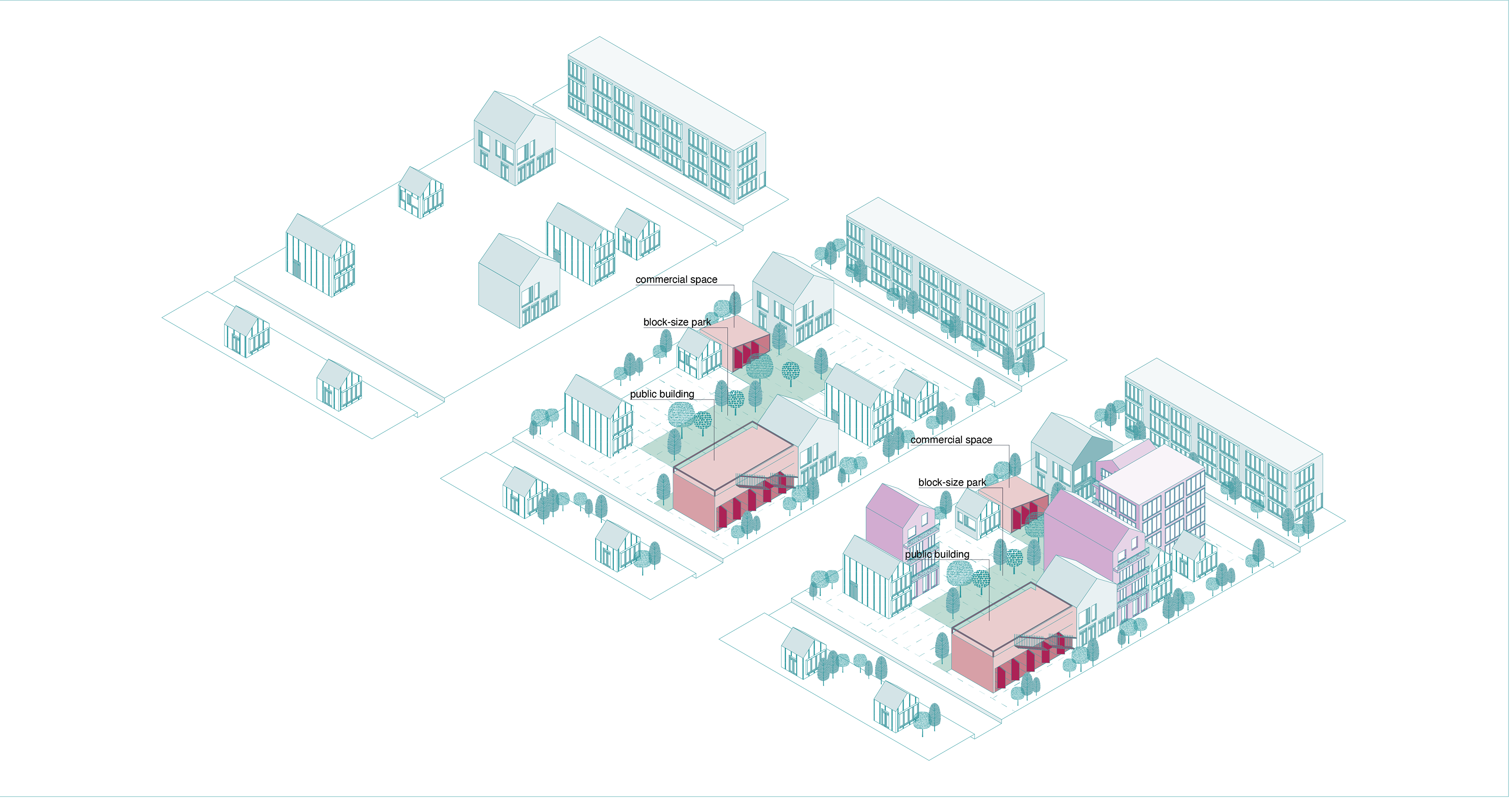
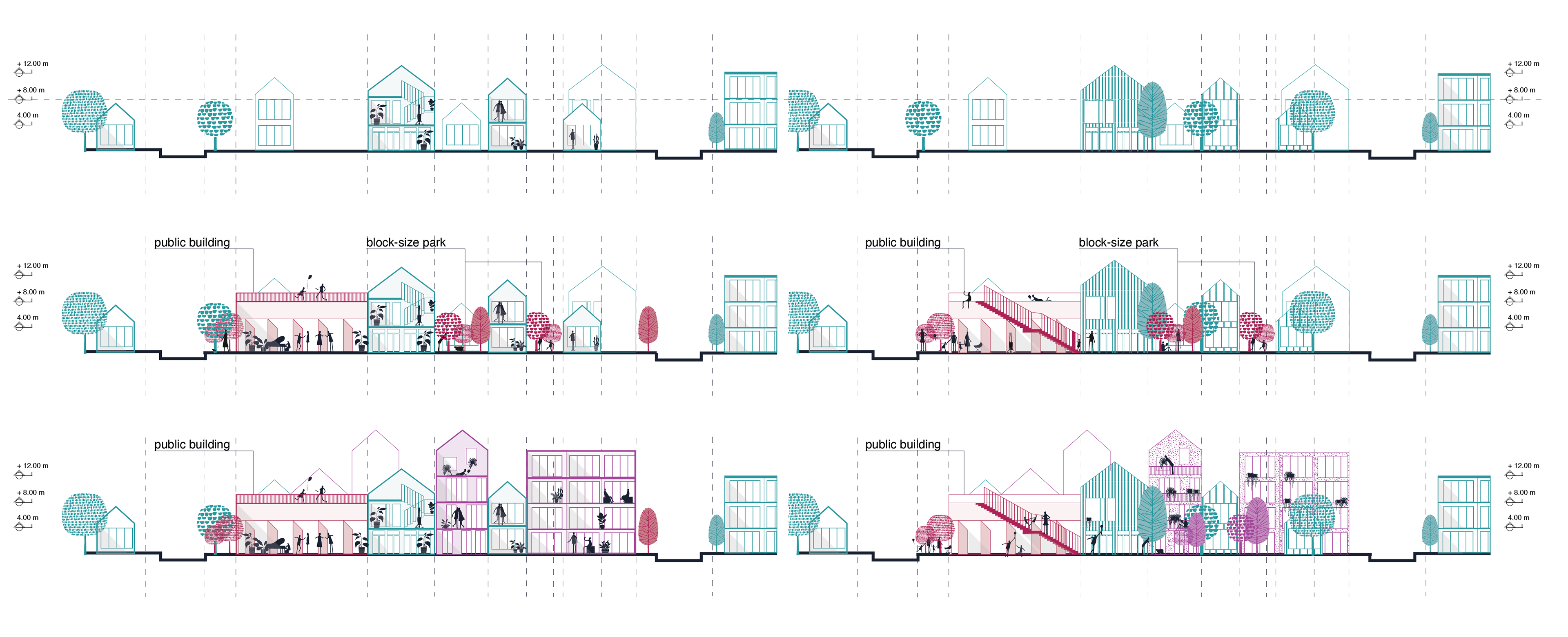
The second step in this project is focused on public infrastructure. This includes the definition and designation of public spaces. The process of defining public spaces will involve differentiating between different types of spaces such as open public space, public building plots, and public squares. This step is important in order to ensure that the areas designated for public use are clearly defined and easily accessible to the community.

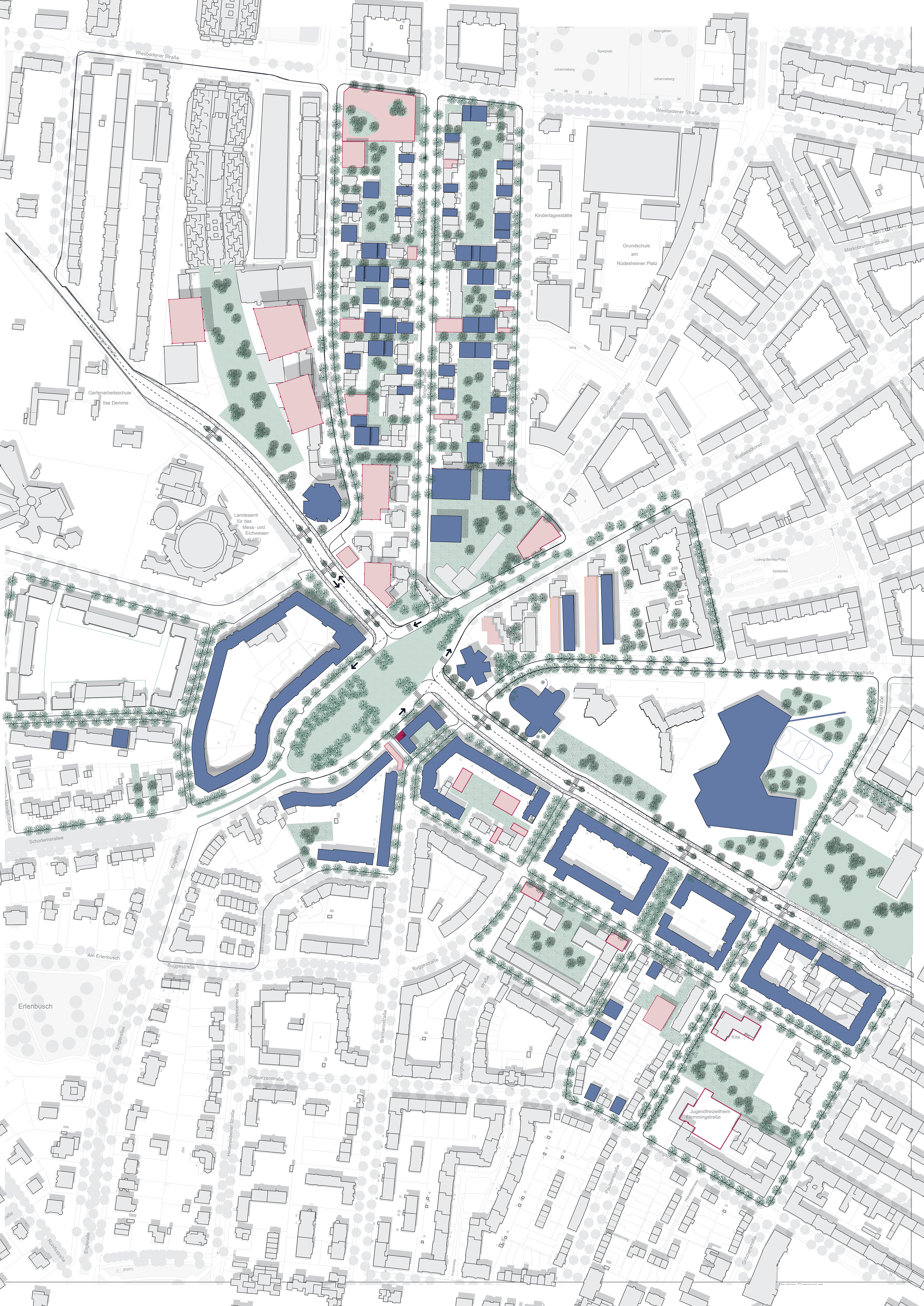
Step 3: Densification
Identification of well-functioning plots to enhance
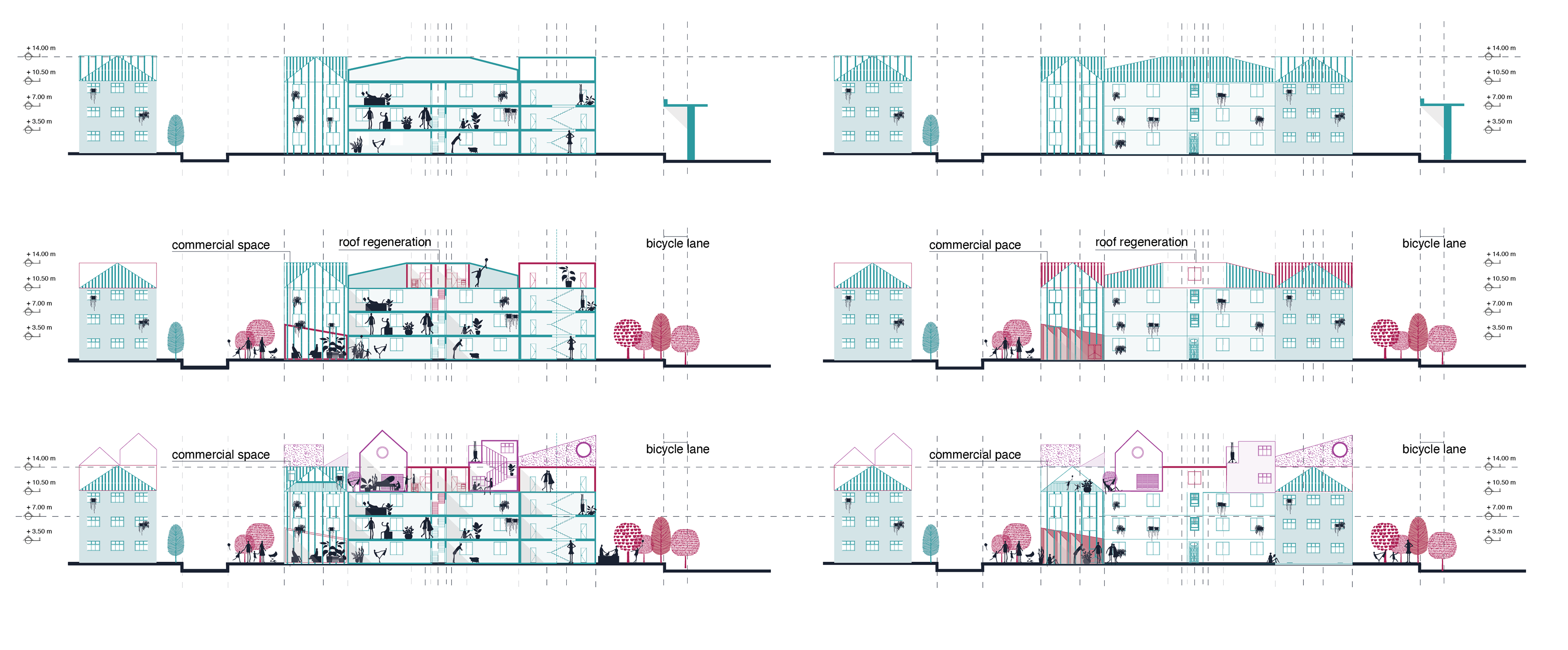
The third step of this project is focused on densification. This includes the identification of well-functioning plots to enhance urban regeneration in a sustainable way. In this step, the well-functioning plots will be enhanced through in-fill solutions, such as developing and building on rooftops. This approach to densification will not only increase the number of housing units in the area but also promote sustainable urban development.
Step 4: Redevelopment
Identification of under-functioning plots to redesign
The fourth step of this project is focused on redevelopment. This includes the identification of under-functioning plots to redesign. The purpose of this step is to identify areas in the community that are not being used to their full potential and to come up with new plans to revitalize these spaces. This could include repurposing the land for different uses, redesigning the buildings or infrastructure, or other changes to improve the functionality and livability of the area.
Step 5: “More things to do” & “Where do people live”
Identification of commercial and residential facades
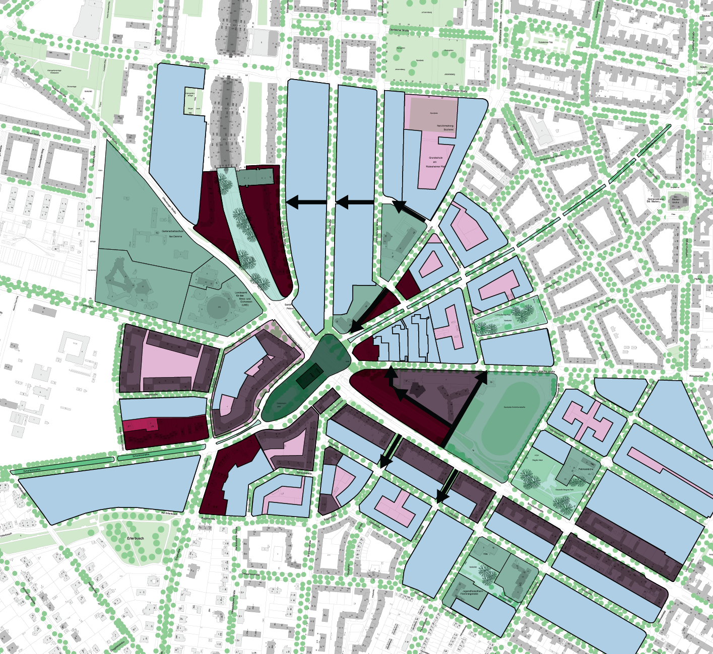
The fifth step in this project is focused on identifying and designating commercial and residential facades. This step is divided into two main objectives: “More things to do” and “Where do people live.” The goal of “More things to do” is to designate commercial facades on main streets, around the square, and around the future park. This will create more opportunities for businesses and activities in these areas. “Where do people live” objective is to designate residential facades on neighborhood streets. This will create more housing options in these areas and promote a sense of community. This step is important in order to create a balance between commercial and residential areas in the community and to ensure that the needs of all residents are met.
Step 6: “Where do people rest”
Definition of block-scale parks and open spaces
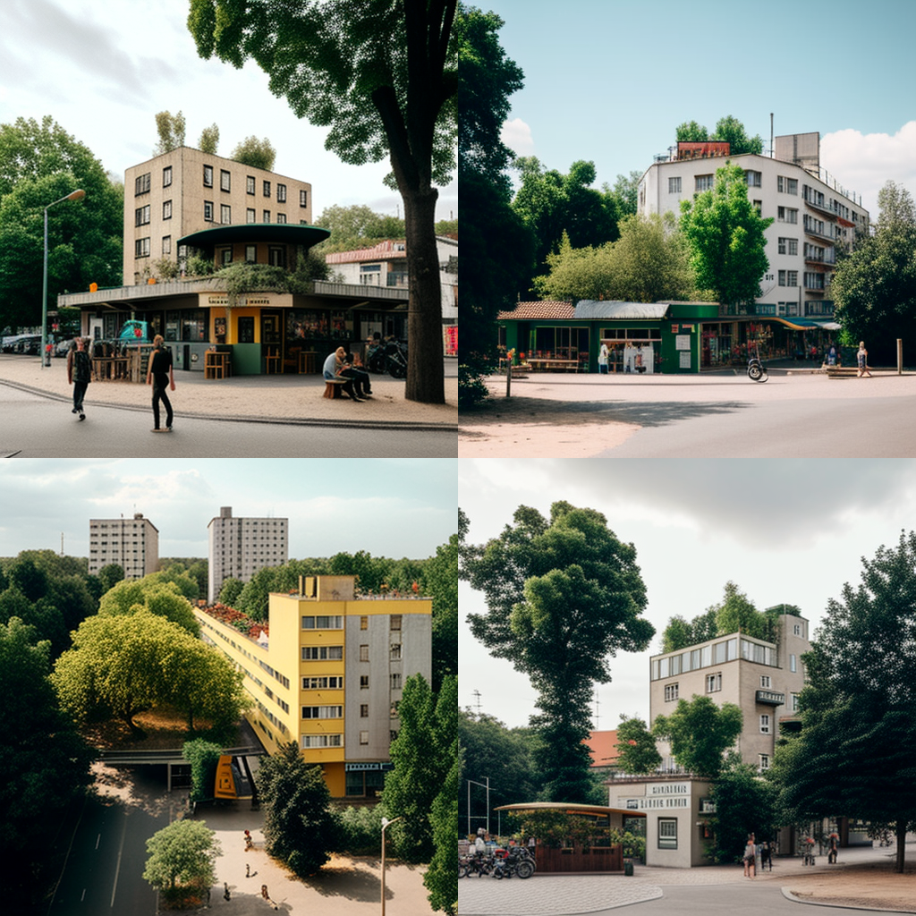
The sixth step in this project is focused on “Where do people rest.” This step aims to provide definition of block-scale parks and open spaces. This is done by creating small residential block-scale parks and open spaces in the heart of the blocks. These parks will be accessible to the public and provide residents with opportunities for leisure and recreational activities. The parks will be managed by a combination of the block residents (70%) and the city (30%). This approach ensures that the parks are well-maintained and responsive to the needs of the community. The availability of these parks will not only provide a space for rest but also enhance the overall livability of the neighborhood.
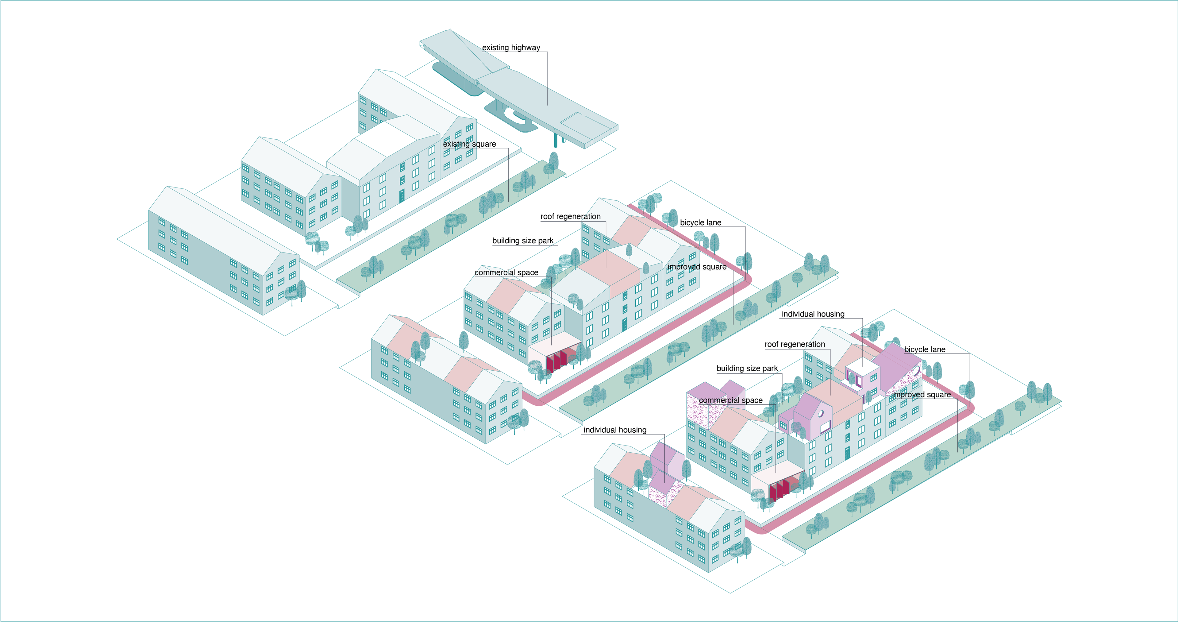
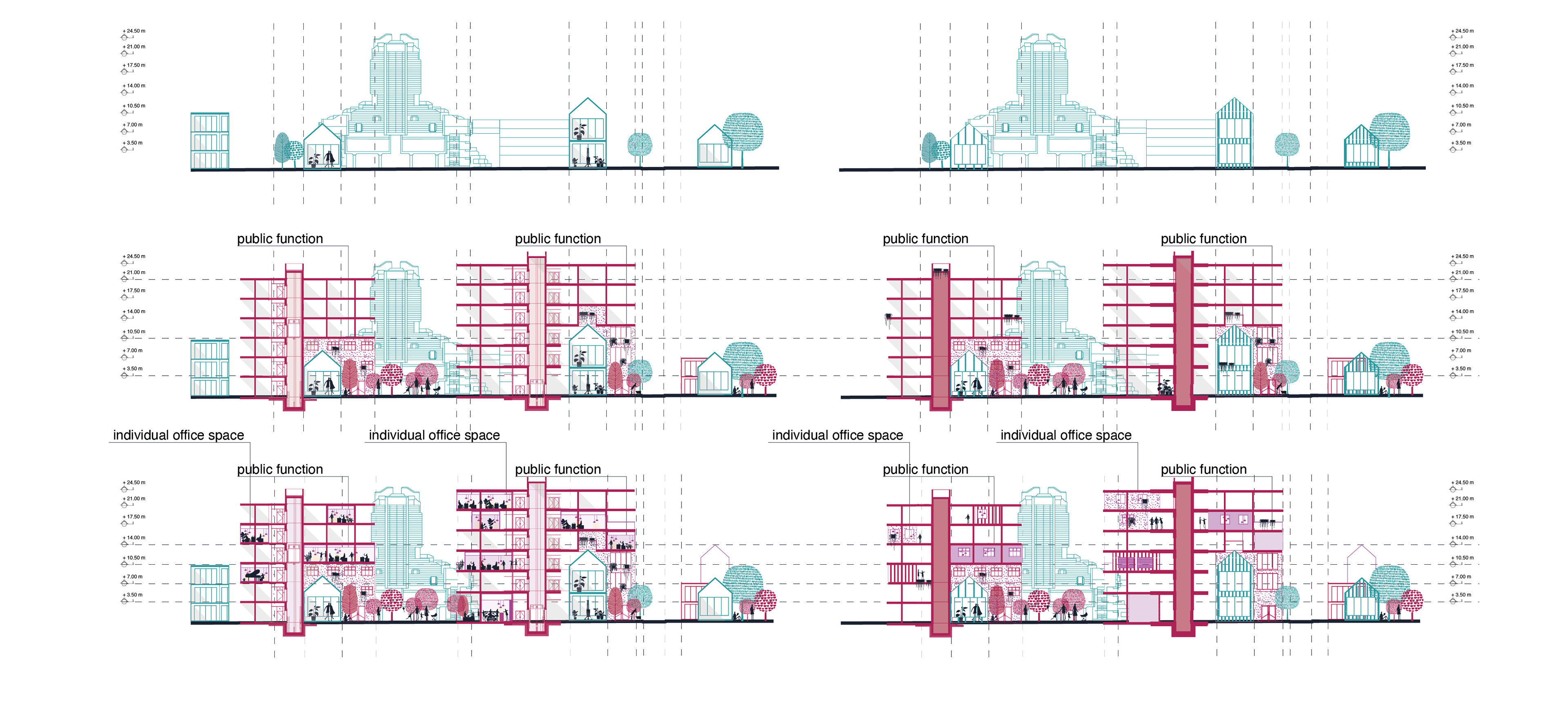
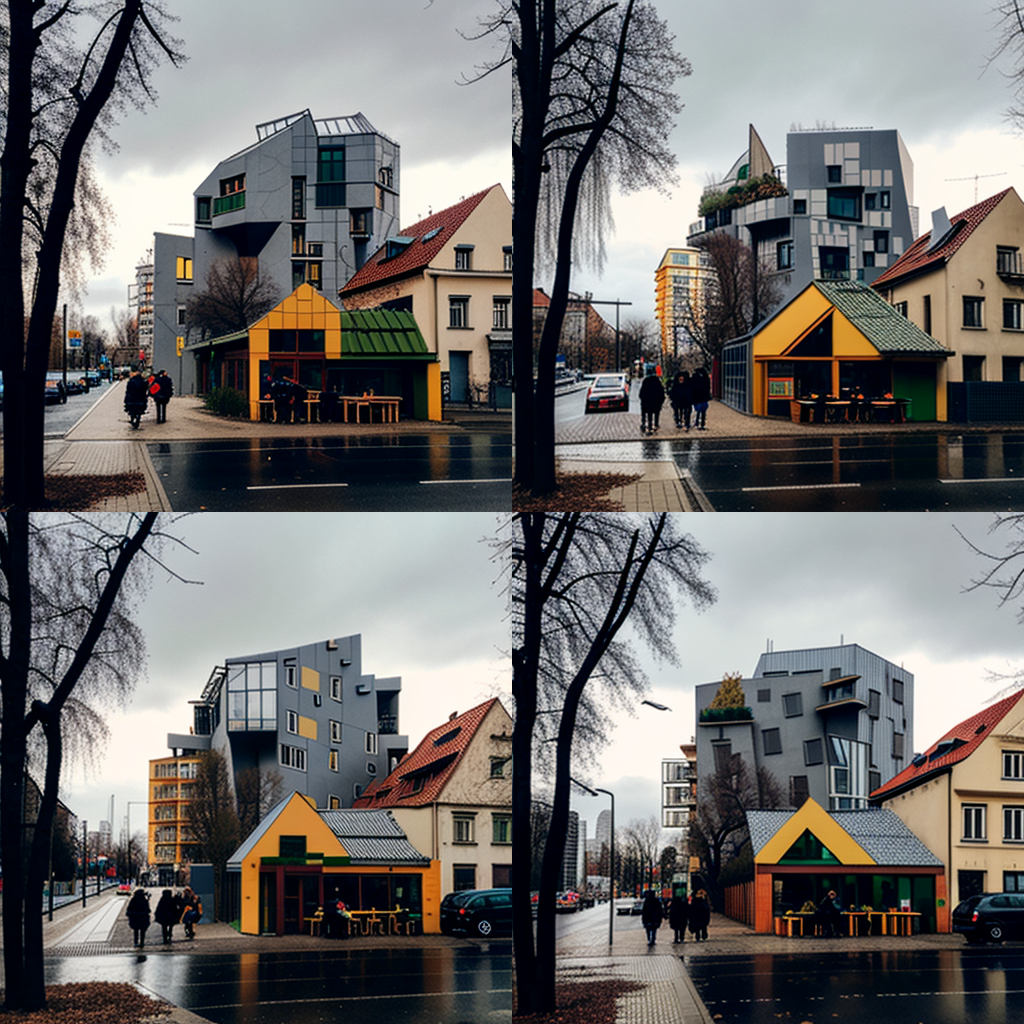
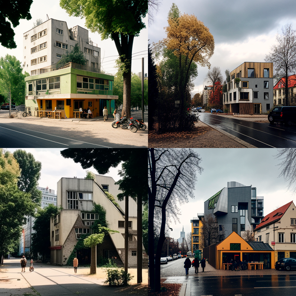
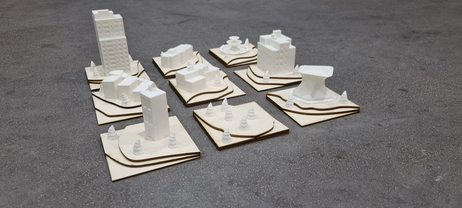
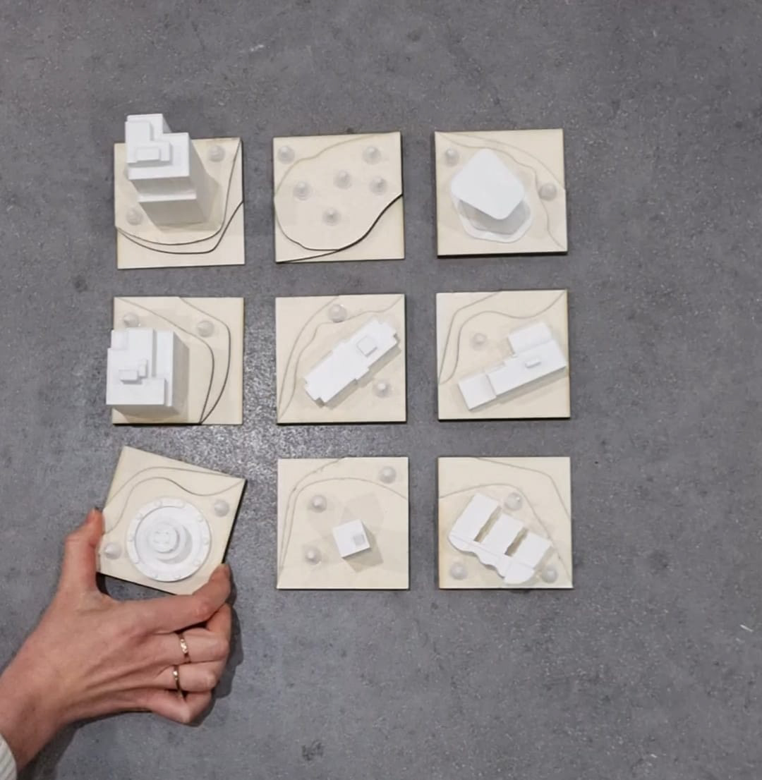
The approach to urban regeneration involves utilizing three different typologies to revitalize the area around the “snake” building on the A104 highway in Berlin. The three typologies include:
1. Redesigning and building on top of existing rooftops to add new housing and commercial space without taking up additional land.
2. Creating residential blocks that combine existing buildings with public infrastructure, commercial uses, and a block-scale park to create a more livable and sustainable community.
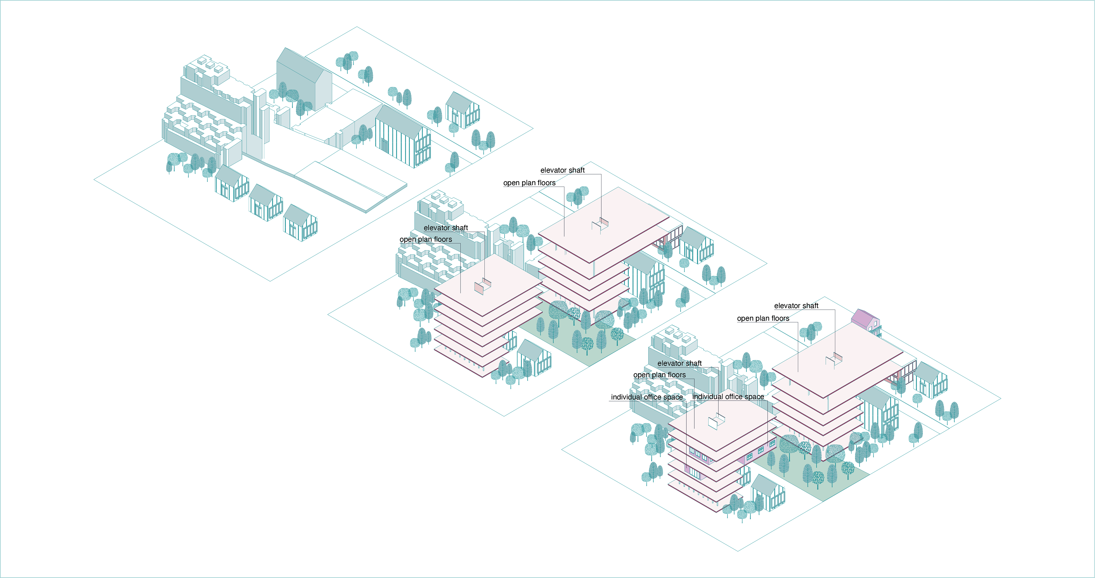
3. Building office buildings and public buildings, designed like park houses, next to the “snake” building to create a new destination for work and leisure.
It is important to note that in all cases, the necessary public infrastructure that supports the regeneration should be built first, to ensure accessibility and livability for residents and provide a foundation for the personal interventions.
It is important to note that in all cases, the necessary public infrastructure that supports the regeneration should be built first, to ensure accessibility and livability for residents and provide a foundation for the personal interventions. The plan for urban regeneration takes into account the phased development and long-term growth of the area. It considers the need for both immediate and long-term improvements, and includes a strategy for phased implementation over time.